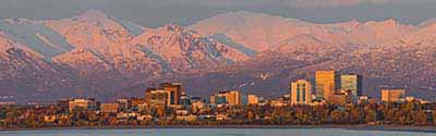
The Alaska Neighborhood Explorer helps you to research any Alaska neighborhood (census block group) and get home values, average household income, owner/renter/ occupancy rates, projected growth rates, boundary maps, comparisons to other communities, and much more.
Alaska State Flower - Forget Me Not
The United States acquired the area of Alaska by purchase from Russia in 1867, with generally the same boundary as the present state. The formal boundary between the southeastern portion of Alaska and Canada was settled by treaty in 1903. Alaska Territory was organized on August 24, 1912. Alaska became the 49th state on January 3, 1959.
See: Geographic Terms & Concepts
Interactive Map of Alaska Boroughs / Census Areas (CA) | Static Overview Map of Alaska Boroughs / Census Areas (CA)
There are 29 county equivalents in Alaska.
Most of the land area in Alaska has not been divided into political subdivisions. Boroughs, cities and boroughs, and municipalities are legal entities. Census areas are statistical entities. In Alaska, there are twelve boroughs, four city and boroughs, and two municipalities (borough equivalent). There are four consolidated governments, Anchorage, Juneau, Sitka, and Wrangell, which are classified as municipal governments.
Alaska has 11 statistical entities called "census areas." Census areas are statistical areas established in cooperation with state government for reporting data in the portion of the state outside any borough. These areas are sometimes referred to as the "unorganized borough" and are administered by the state.
Boroughs and census areas were first recognized as county equivalent entities for the 1980 Census.
-- Select Borough --
Aleutians East County
Aleutians West (CA) County
Anchorage County
Bethel (CA) County
Bristol Bay County
Chugach County
Copper River County
Denali County
Dillingham (CA) County
Fairbanks North Star County
Haines County
Hoonah-Angoon (CA) County
Juneau County
Kenai Peninsula County
Ketchikan Gateway County
Kodiak Island County
Kusilvak (CA) County
Lake and Peninsula County
Matanuska-Susitna County
Nome (CA) County
North Slope County
Northwest Arctic County
Petersburg Borough County
Prince of Wales-Hyder (CA) County
Sitka County
Skagway County
Southeast Fairbanks (CA) County
Wrangell County
Yakutat County
Yukon-Koyukuk (CA) County
There are 37 county subdivisions known as census subareas in Alaska.
Alaska State Bird - Willow Ptarmigan
Alaska has 148 incorporated places and 207 census designated places (CDPs) . The incorporated places consist of 144 cities, 3 city and boroughs, and 1 municipality. There is no minimum population for incorporation in Alaska.
Alphabetical List of Cities, Towns, CDPs and Other Populated Places A | B | C | D | E | F | G | H | I | J | K | L | M | N | O | P | Q, R | S | T | U, V | W, X, Y, Z
Alaska Civil Features : Political Subdivisions, Native Areas, Land Grants, etc. - sorted by Census Class Codes .
There are 2 Metropolitan and 2 Micropolitan Statistical Areas in Alaska. AK Metopolitan & Micropolitan Areas
There are 238 ZIP Code Tabulation Areas (ZCTAs) in Alaska. View Alaska ZIP Codes and ZIP Code Maps .
Alaska has 53 unified school districts. View Alaska Public and Private Schools .
Alaska has 1 congressional districts. An interactive map shows the contact information for each Representative as well as the boundaries for each Alaska district. View Map of Alaska Congressional Districts .
There are 20 state senate districts and 40 state house districts in Alaska.
Alaska has one federally recognized American Indian reservation.
Alaska Native Regional Corporations/Alaska Native Areas
There are 12 Alaska Native Regional Corporations (ANRCs) whose boundaries cover the state outside of the area of the Annette Islands Reserve. ANRCs were created pursuant to the Alaska Native Claims Settlement Act (ANCSA) and organized under the laws of the state of Alaska to conduct both the for-profit and non-profit affairs of Alaska Natives within a defined region of Alaska. These are considered legal geographic entities by the Census Bureau. A 13th corporation comprises of Alaska Natives residing outside of the state; however this corporation is not reflected in Census Bureau products because it has no defined geographic extent. Within the corporation boundaries are 220 Alaska Native village statistical areas (ANVSAs).